The map is central to SmarterWX and provides many helpful tools for you to navigate and adjust the display of the map.
Zooming in and out
There are many ways to zoom in and out. The simplest way is to use the +/- buttons in the top-left corner.
You can also double-clicki to zoom the map in or hold down SHIFT and DRAG the mouse to zoom in to a specific area.
As you zoom out the map may change to show the data as clusters instead of points. This is to avoid overpowering the map with too much information.
Going to your default extent
Your organisation’s area of operation is shown on the map as a green outline. Clicking on the HOME symbol in the top-left corner will zoom the map to your area of operation.
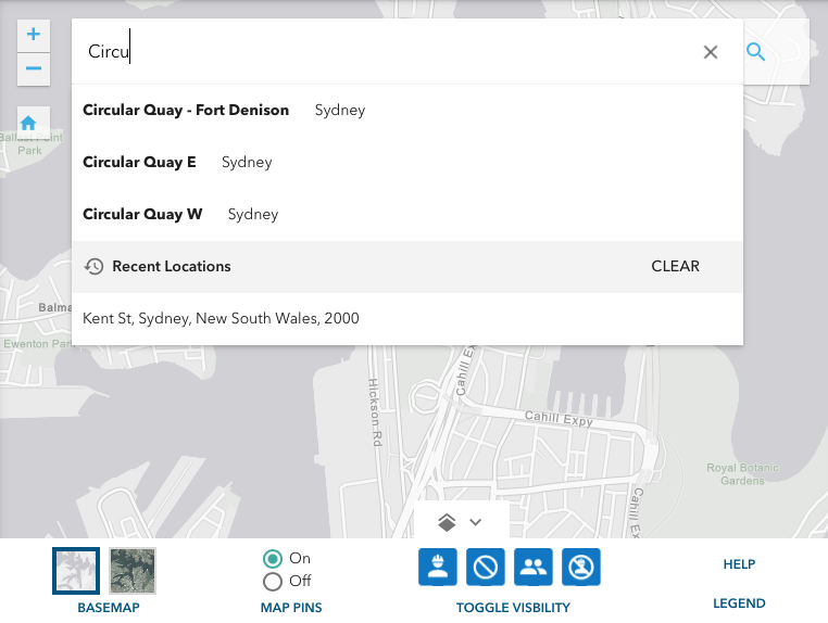
Searching for a specific address
Click on the magnifying glass in the top-right of the map to open the search by address box. You can enter a full address or a suburb name to zoom the map to that location. Your most recent searches are shown at the bottom of the list to provide easy access to your favourite locations.
Setting map display options
Click on the layer button in the bottom-centre of the map to reveal the map display options. In here you can choose what gets displayed on the map: –
- Basemap – choose between a satellite view or a street map for your background.
- Map Pins – you can turn on and off the pins shown on the map in favour of seeing the polygons (areas) only. This can help to remove clutter from the map.
- Item Visibility – you can quickly turn on and off different types of object on the map without having to adjust your search options. Toggling these buttons affects the map display only – it does not change the search results shown on the list.
View map legend
Click on the LEGEND link to show the map legend (or key), explaining the different colours, icons and shapes used on the map.